You can’t be everywhere on your land at once. Get a drone’s eye view and get the big picture of what’s happening on your land. When you use our ag drones for imaging, you gain insights into areas you may have missed on your own, or that would have taken longer to find on the ground.
We will translate what you’re seeing from the images the drone collects and help you create a plan of action for areas that need your attention.
Ag drone imaging gives you eyes in the sky, allowing you to find sections on your land that require different treatment plans than other areas. This ensures your ag spray applications aren’t wasted but targeted.
This not only saves you time and money, but also strengthens your crops, and is friendlier on the environment.
Imaging Toolkit
Regular photos that document your fields with crystal clarity
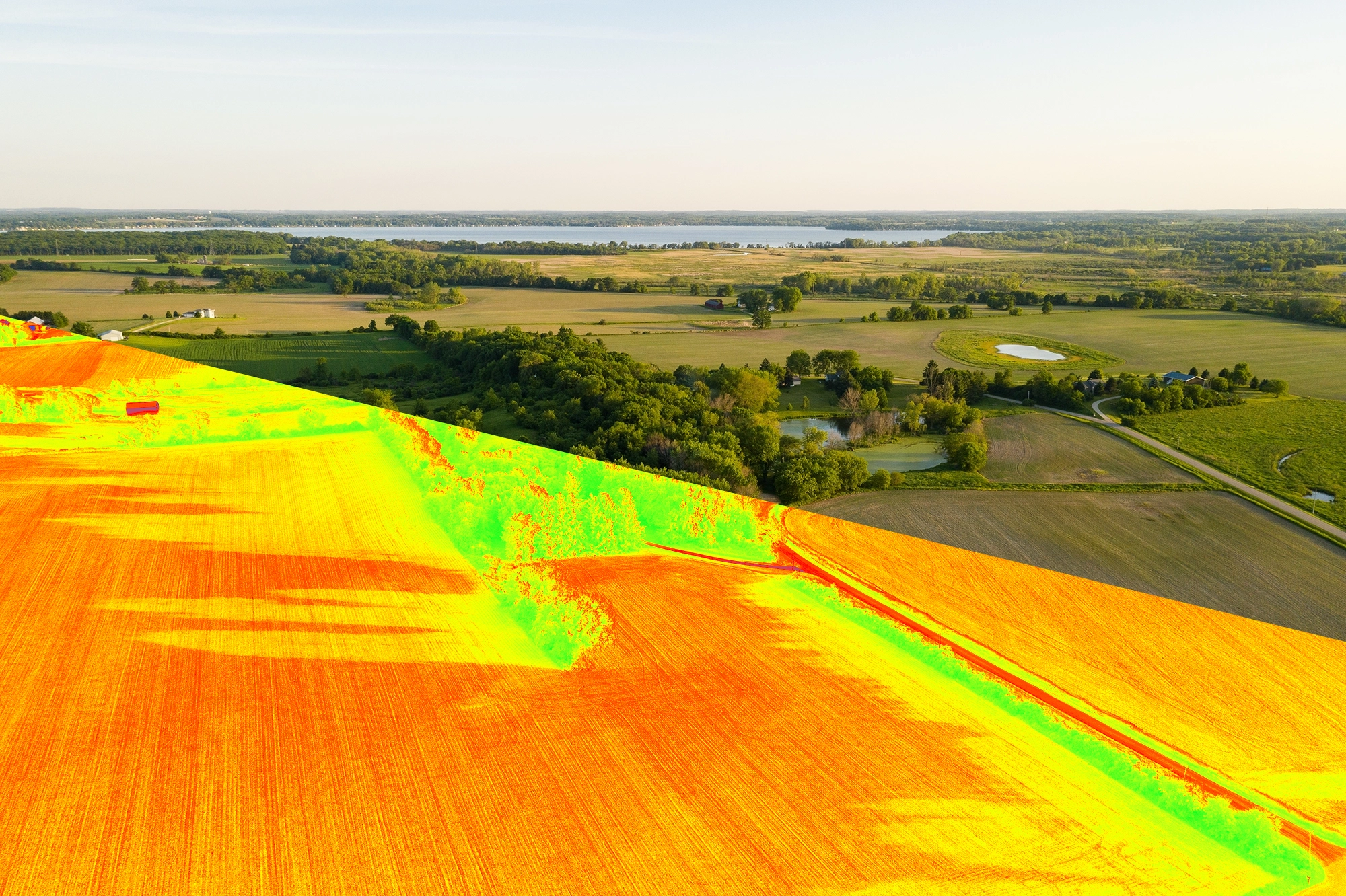
NDVI maps that show you exactly which areas are stressed
Thermal imaging cameras that help pinpoint irrigation issues
Multi-colored imaging that catches disease early
3D field mapping that helps with drainage and water management
Contact Us
Reach out to us for more information or to schedule an assessment.